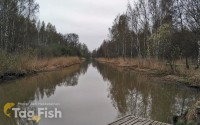
The Mitchell River is a perennial river of the East Gippsland catchment, located in the Australian state of Victoria. The unregulated river provides a unique example of riparian ecology, flowing generally south with the catchment area drawing from the steep mountains of the Victorian Alps to enter Lake King, one of the Gippsland Lakes, and then empty into the Bass Strait.
Formed by the confluence of the Wentworth and Wonnangatta rivers and Swamp Creek near Horseshoe Bend, north of the national park that bears its name, the Mitchell River rises in Lake Tabberabbera, drained by runoff from the southern Victorian Alps of the Great Dividing Range. The river flows generally south in a highly meandering course in its upper reaches through the Mitchell River National Park, and then south by east as it spills onto the fertile Gippsland Plain west of Lindenow. The river then flows generally east towards Bairnsdale and empties into Jones Bay, part of Lake King, within the Gippsland Lakes via the silt jetties, a narrow 8 kilometres long digitate delta. Within the lake, the Mitchell is joined by the Nicholson and Tambo rivers; and then enters Lake Victoria, where the Mitchell and Latrobe rivers form their confluence, with the Mitchell reaching its mouth in Bass Strait, south of Lakes Entrance. The river descends 137 metres over its 121-kilometre course; joined by more than thirteen tributaries, many of which are surrounded by dense native forest.